
The national institute of geography and forestry, also known as the IGF, has just launched a fantastic initiative through their new tool called Rewind Time (« Remonter le temps »).
It is “a new unique service that permits you to observe the evolutions of our region throughout time.”
We enjoyed watching our region evolve through time because even though the Gulf of Saint-Tropez is known worldwide today, it was made up of humble fishing villages until the beginning of the 1950’s.
Port Grimaud

Map of Port Grimaud in the XIXth century
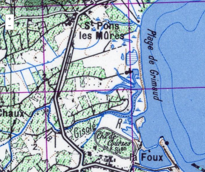
Port Grimaud, a swamp in the 1950s
These two images show Port Grimaud as it was up to 1976: swamps. It was nothing like the pretty Provençal village with snaking canals that we are familiar with today.
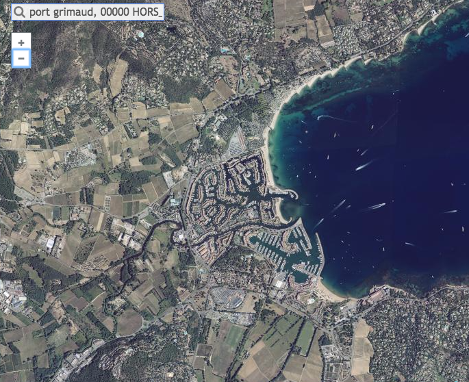
Bird’s-eye view of Port Grimaud nowadays
Saint-Tropez
Saint-Tropez had a large influx of tourists starting in the 1950s, when the world-famous Brigitte Bardot made the world discover the charm of this fishing village.

Saint-Tropez : Map from the Army published between 1825 and 1866
You will notice that in the 19th century, there was not yet a Gulf of Saint-Tropez but the Gulf of Grimaud, since Grimaud was the largest village in the region.
Since then, the aerial view of Saint-Tropez shows the ballet of yachts around the port.
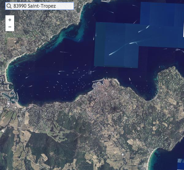
- Aerial view of Saint-Tropez in 2016
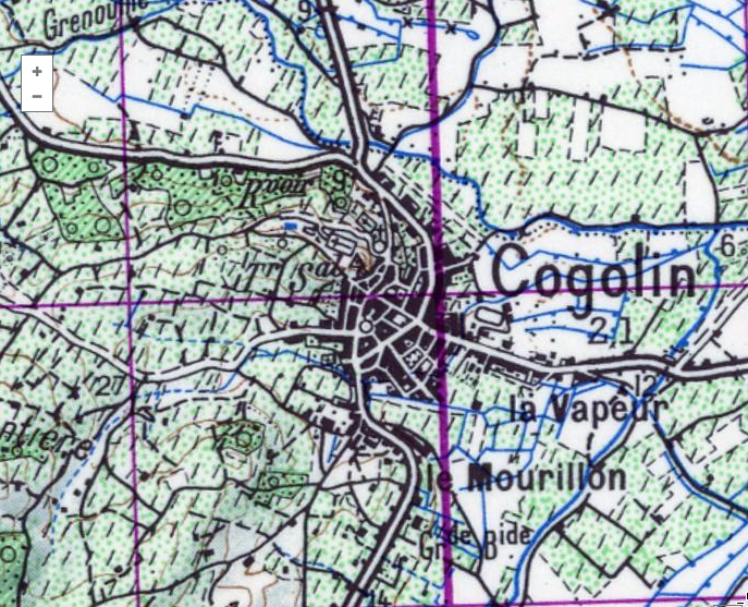
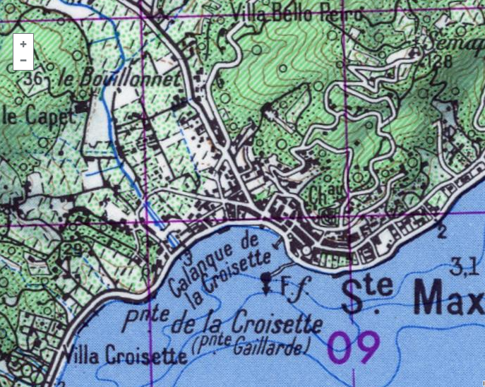
Cogolin

Cogolin on the Army map in the XIXth century
Cogolin in 1950
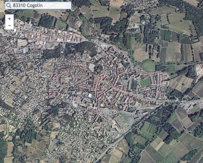
Cogolin in 2016
This tool is very fascinating because it allows us to see the images of urbanization around the Côte d’Azur. You can see that on the photographs and maps of Cogolin that the principal axes of transport have remained the same for two centuries.
Sainte-Maxime
Sainte-Maxime in 1950
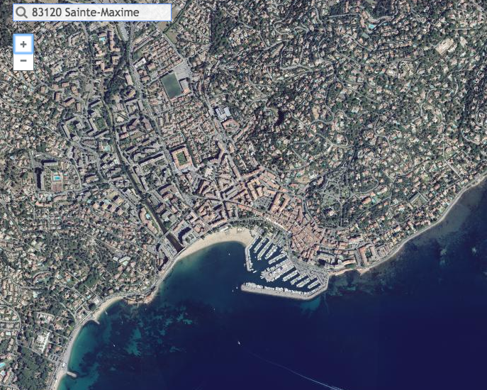
Aerial view of Sainte-Maxime in 2016
The rise that Saint-Maxime had between 1950 and today is impressive. Notice what the port of Saint-Maxime looked like only a few decades ago and how much we’ve built inland since then!
Sources: all the screenshots were done on the site of the IGN.